

Location: ///probe.bolts.tickle
The Rodney Rise area offers about 10 miles of trails across the ten named trails. You can access this area from at least 6 different trailheads and each access point provides a very different experience. A couple of the trailheads are located on Orofino Gulch Drive. The Oro Fino Gulch Drive trailheads offer very limited parking, but the trails are really wonderful. The slope above Oro Fino faces west and is shaded for a lot of the year. So, this a much cooler and damper area to walk than many of the more open and exposed areas on Mounts Ascension and Helena. The remainder of the Trailheads have better parking and Old Rifle Range even offers a vault toilet. The Rodney Rise area has abundant wildflower, butterfly, and birdlife during the nicer months.

Old Shooting Range Trailhead
Location: ///sings.alright.applauding
This is a great launch point into the Rodney rise area. Lots of parking, vault toilets, and several trail choices right at the trailhead. You can go up the Rodney Meadow trail switchbacks to a lovely meadow area, cross Davis Gulch and go up Archery Range and Entertainment Trails, or take a leisurely walk up the Upper DeFord Universal Access trail towards Dry Gulch Road. Be aware, there are two portions of DeFord, an upper and a lower trail. The upper trail is bike traffic only. The lower portion has been reconfigured and is now a very nice accessible trail.

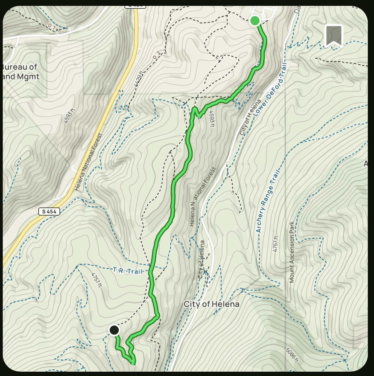
Rodney Street Trailhead
Location: ///probe.bolts.tickle
Rodney and Sparta streets converge at the trailhead parking area. The sole trail leading from this trailhead to the rise is named the Rodney Ridge Trail (see images below).
About .75 miles (1.2k) in, it intersects the Don’t Fence Me In Trail. If you stay left, the Ridge trail takes you into the Rodney Meadow area above the Old Shooting Range Trailhead where you can access all the other trails in that area. In my mind, the Rodney Ridge trail is actually a series of several trails – T.R. Trail, Top of the World, and Rent Money.
One of the Rodney Ridge trails sticks (more or less) to single tracks, the other way might be an unauthorized trail, but it more closely follows the actual ridgeline. No matter how you walk it, the Rodney rise area is a wonderful, compact, diverse trail system that abounds with birds, wildflowers, and butterflies from March through September.


Acropolis Crest Trailhead
Location: ///mixing.feuds.happens
This is a “blink-and-you’ll-miss-it” trailhead. The Parking area is a paved area between two sections of one-way traffic on Cruse Ave. just uphill from the Lewis and Clark Public Library. The parking area shares the space with a couple of large recycling bins. Not one of our more attractive access points, but the trails are lovely. The Acropolis Crest Trails join up with Sparta Street and leads you to the Rodney Street Trailhead.

Waterline Trailhead
Location: ///save.markers.extra
The Waterline trail is cool and damp most of the year. The main trailhead is just a bit outside the Helena City Limits up Oro Fino Gulch Drive. It parallels Oro Fino, so traffic noise can be quite noticeable. The Don’t Fence Me In trail climbs up to the left about 1/10 of a mile (.16k) up the trail, just past the switchbacks. About .5 miles (.8k) in, it intersects the Rodney Meadow trail and an additional 6/10ths of a mile (.95k) Waterline runs into the T.R. Trail. Waterline continues up Oro Fino Gulch for another .8 miles (1.2k) where it crosses the road and turns into the Barking Dog trail that leads up into Wakina Sky.
